Capital Construction

The Silver Line Gateway - The BRT Project the MBTA Can't Afford to Screw Up

The Silver Line Gateway through East Boston to Chelsea is the best opportunity for the MBTA to do BRT right and provide quality service to Chelsea, Boston's forgotten un-borough.

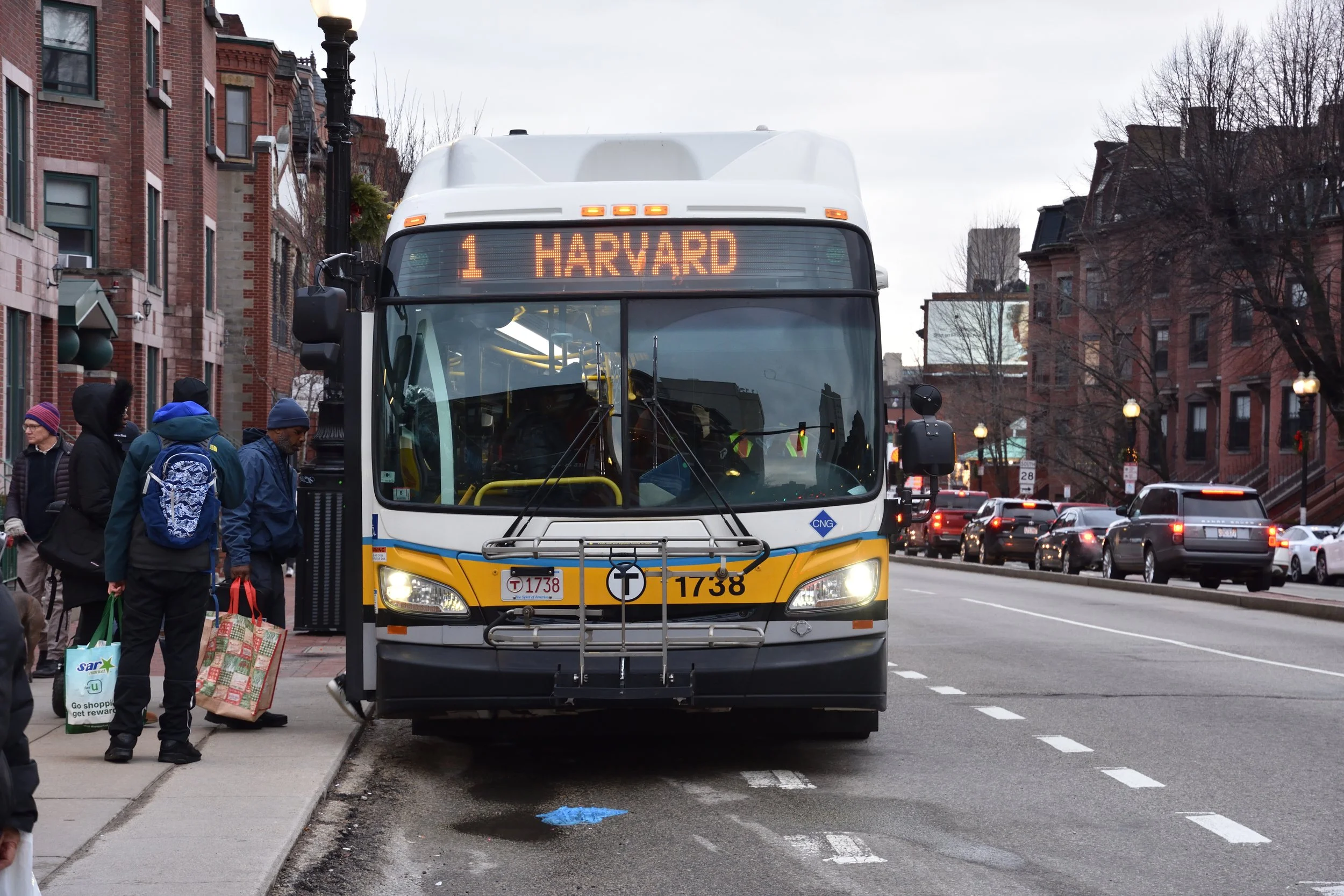
This evening's meeting in the Chelsea City Hall chambers played out like how I imagine the public meetings would have gone in the planning stages of Staten Island's S79 SBS project, but perhaps with fewer pitchforks and much lighter attendance.

Chelsea and Staten Island share a lot in common, despite Chelsea not actually being incorporated into the City of Boston. Both are traversed by many bus routes and have largely been neglected parts of their metropolitan areas despite being so geographically close to downtown proper.

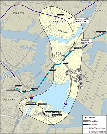
This is where the as yet unfunded Silver Line Gateway project is supposed to come in. Costing anywhere between $20 and 70 million for the conservative estimates of the three alternatives, the project will bring Chelsea within 20 minutes of the Seaport/Innovation district and few minutes more to South Station.

Internationally recognised as the picture of how not to implement bus rapid transit (BRT), this is an opportunity to build confidence that MassDOT can do it right while still including the public input and consideration that didn't happen with the cancelled Blue Hill Ave BRT.

Weighing the Alternatives

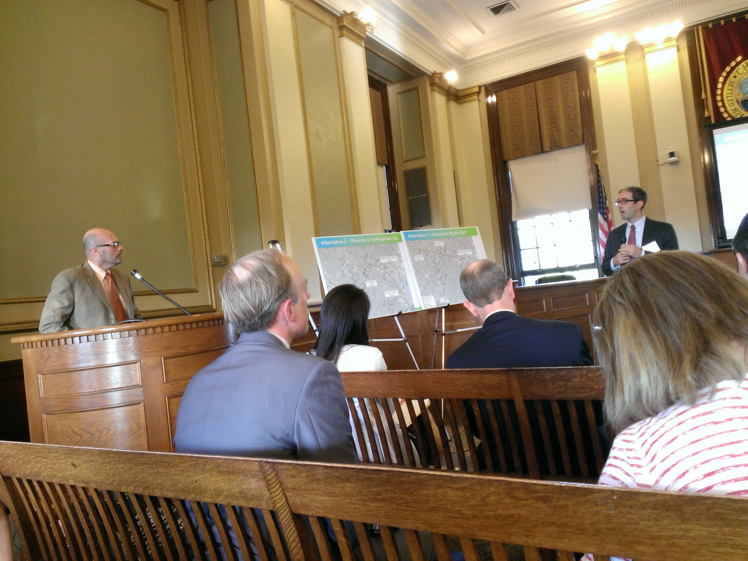
One of the most contentious alternatives that showed up again this evening was the street-running third alternative. It proposes elimination of parking along the spine of Central Avenue from the Chelsea Street bridge to Hawthorn Street to install a dedicated bus lane with bus signal priority. Nearly 84 spaces would be eliminated, some of which would be in front of residences in a neighbourhood already stuggling to deal with parking.

The second alternative includes an in-street bus stop in front of City Hall on Broadway, enabling buses to loop around and drop off passengers on a contiguous platform and avoid crossing two lanes of traffic. If this alternative were exercised, the various routes that pass along Broadway could offer platform transfers to the Silver Line and other bus routes. This, too, would eliminate parking, but instead metered parking in front of City Hall.

One resident suggested introducing a signallised intersection at the corner of Broadway and the Washington Ave loop to allow buses to cross the 2 lanes safely, but CTPS project manager Scott Hamwey cited this decision wasn't considered because of the noncontinuous sidewalk on the right side of Broadway opposite City Hall.

The Silver Line Gateway through East Boston to Chelsea is the best opportunity for the MBTA to do BRT right and provide quality service to Chelsea, Boston's forgotten un-borough.

The Emotional Battle Over Parking

Chelsea's long-forgotten status has similarly led to a fondness for parking and driving as Staten Island. Various residents, interested parties, and Chelsea council members voiced stern but understandable concern over the elimination of parking and the project's potential to entice more people to drive and park in Chelsea to ride the Silver Line extension. All of these concerns of course not being unique to Chelsea, having been echoed all around the world at nearly every public meeting involving removal of parking for dedicated bus lanes to introduce BRT.

The cry for parking, more parking, or recouping lost on-street parking with more off-street parking is a clear symptom of many decades of being under served by transit. 'Parking is a very emotional issue', Hamwey said as he tried to address and acknowledge the comments on street-running alternatives.

The most emotional of these appeals was that of Matt Frank, District 3 Councillor of Chelsea. Frank cited a multi-generational concern about parking, that removing parking along Central Ave would affect families who have been in Chelsea for decades. 'You're telling them...to just leave', sending the message that, 'you can't live here anymore just because you have to drive.'

Ann Houston, executive director of The Neighborhood Developers, weighed in on the 'crazy traffic problem' and the fact that she '[lives] the parking battle every day'. Despite a recently introduced resident parking program, there is no mention of formula-based parking quotas or any allusion to a comprehensive transportation plan, which will likely mean the parking program will have little to no effect on the pressure for parking.

Ideally, those who will soon move into upcoming development of Chelsea's 'Box District', headed by Houston herself, won't need parking, especially if this project is followed-up with a re-alignment of bus routes to feed the Silver Line extension instead of duplicating its service. Besides, various indicators suggest we may have passed 'car peak', but we'll only see continued auto-dependence for some residence of Chelsea if we don't commit to improving transit now.

Beyond Chelsea's borders, the project may lure downtown workers from neighbouring towns to drive and park along the route, threatening to make 'scarce' parking more difficult to attain. Suggestions of building garages like that at Alewife to absorb the influx of drivers transferring to the Silver Line at Chelsea were not considered because they would be outside of the scope of the project.

The biggest threat to increasing parking demand in Chelsea is the ease of getting off Route 1 just before the Tobin Bridge and parking at the Mystic Mall stop in the first alternative. If not properly mitigated or abated, parking demand could spill out of the mall parking lot and into the adjacent neighbourhood.

Comprehensively Comprehending Transit in Chelsea

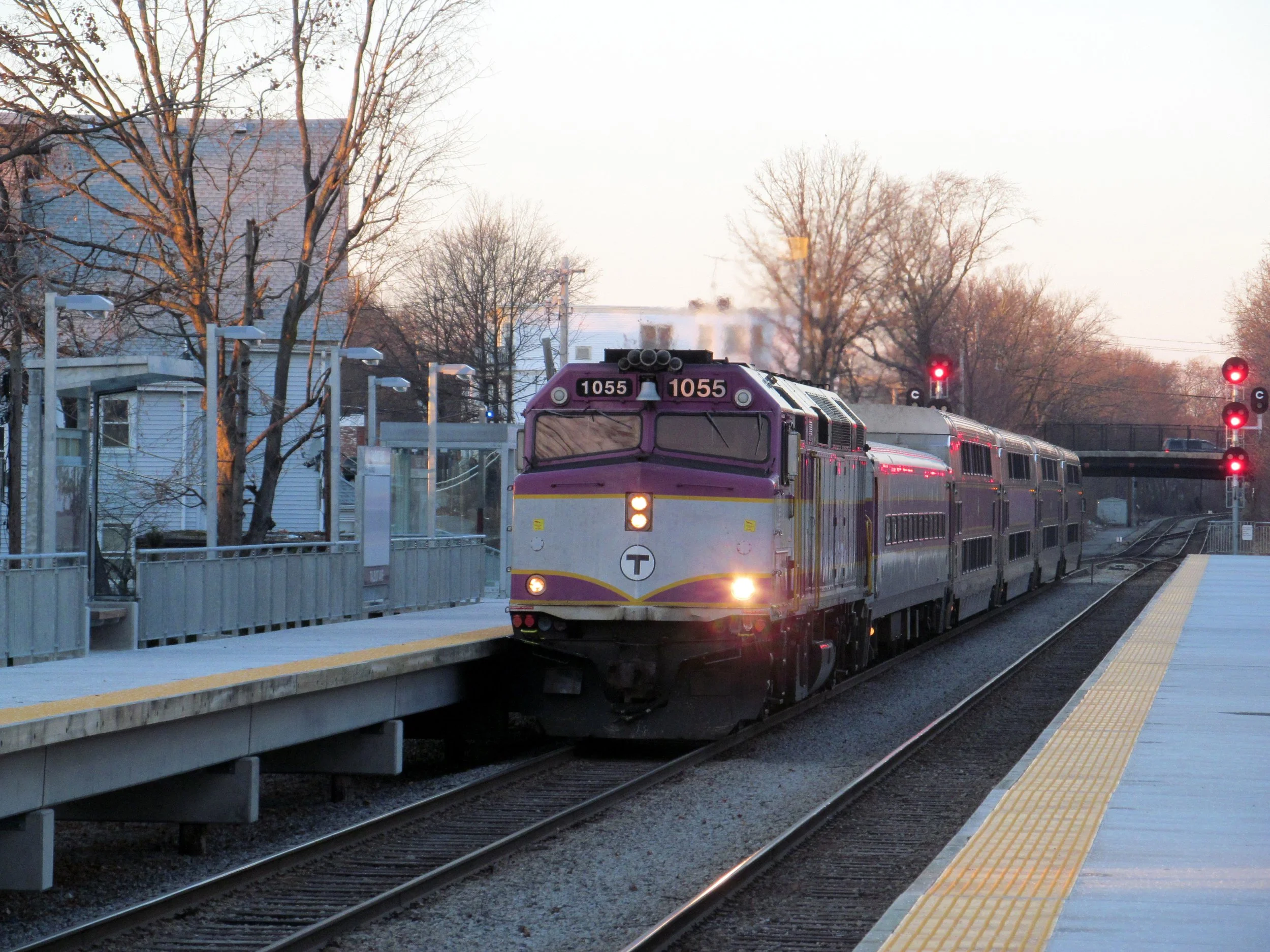
Commuter rail, despite being a one-stop ride into downtown Boston, is an often overlooked, non-obvious route, even to long-time residents, like Dan Cortell, Chelsea Council President. Cortell, whose mother was visiting the past weekend, admitted to forgetting about the MBCR stop on 6th Street served by the Newburyport and Rockport branches on a less-than-memorable non-clock-face schedule, even during rush hour. The commuter rail's non-integrated fare system and near-mystical fare structure also came up as a deterrent in a discussion with a member of CTPS after the meeting.

Congestion on the 111 is often so bad that rear door boarding is required to keep buses on time when leaving from Haymarket.

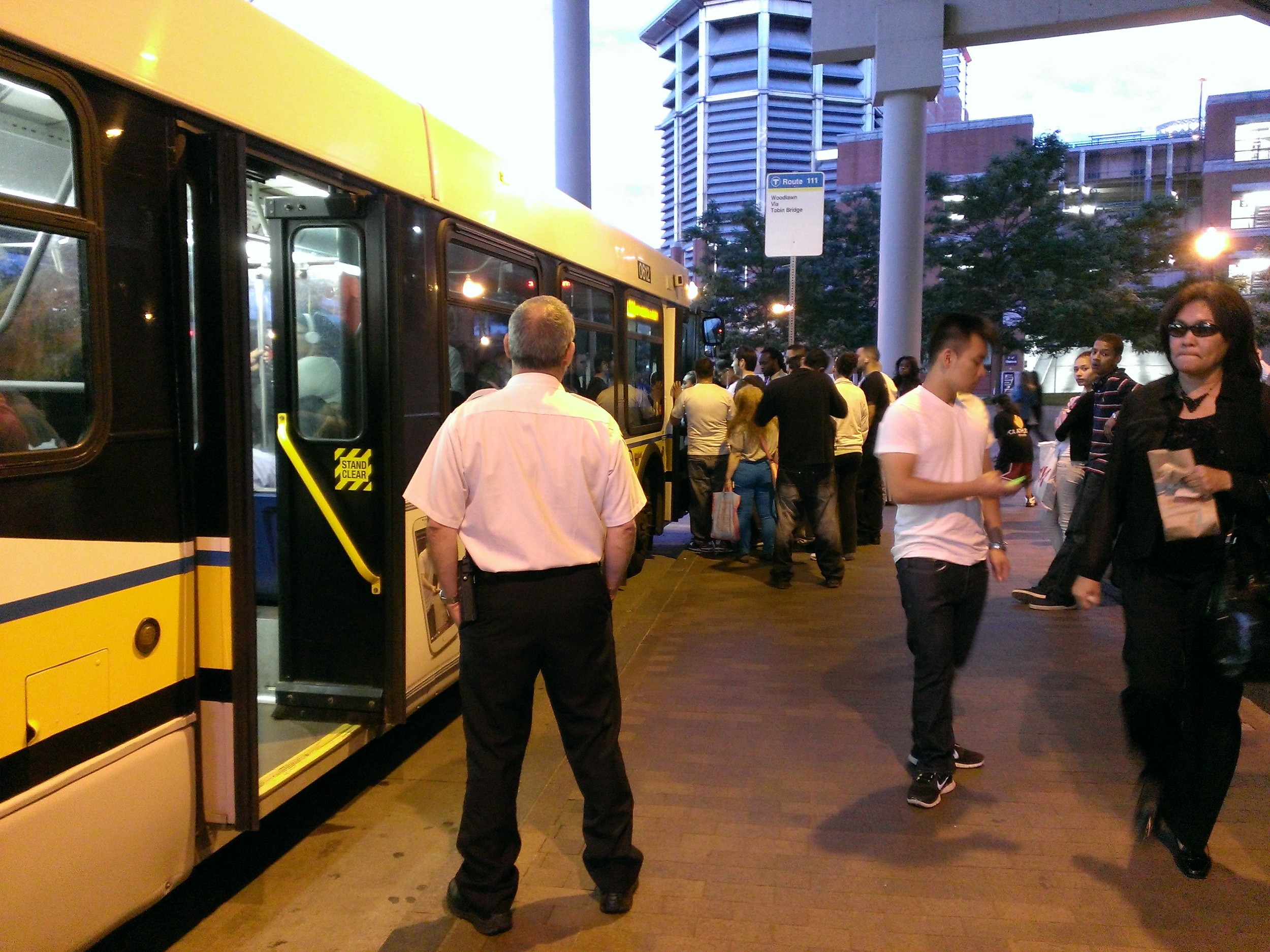
Even worse, transit is unreliable or too time-intensive as compared to driving for 'choice' riders who have the alternative to drive. Speaking frankly, Cortell admitted to having to resort to driving to his job at South Station instead of taking the 111 that stops immediately outside his house because of the debilitating traffic that chokes the 111 into Haymarket at rush hour.

One possible solution to the clear accessibility problem of Chelsea as a whole is a comprehensive evaluation and realignment of the existing bus routes in Chelsea to feed the new Silver Line extension instead of continuing to duplicate service. Cortell was very interested in the potential of wooing choice riders like himself and providing even better service to the large transit-dependent Latino community in his district.

Unfortunately, it's still too soon in the project's development for CTPS to officially start exploring, but it shouldn't be overlooked as a way to gain project support from area residents and ensure transit-oriented development in the neighbourhood doesn't suddenly become transit-oriented parking. Additionally, Chelsea needs to more seriously consider a comprehensive study on parking and ensure that the TOD doesn't induce yet more parking on the principle that parking begets driving begets parking demand (and ugly, unwalkable architecture).

Unlocking Transit-Oriented Development

The biggest threat in the long run may be the gentrification of Chelsea, which will adversely and disproportionately affect the large transit-dependent Latino community and potentially uproot those who have called Chelsea home for generations.

Transit-oriented development is needed to absorb the impending influx of new residents if the project unlocked Chelsea as a transit-accessible alternative to Cambridge, Somerville, and Boston. The rental community is at severe risk if new developments cannot stave off the increase in property desirability, potentially driving rents up in Chelsea and East Boston as high as or higher than Boston, Cambridge, or Somerville.

There is a sea of parking lots or light industrial that could be developed adjacent the Tobin Bridge and the area surrounding the Mystic Mall. These would be well-served not only by the Silver Line extension, but also the comprehensive realignment of buses to improve transit accessibility within the city of Chelsea.

It's imperative Chelsea and MassDOT get ahead of the game with value capture taxes because capital projects that induce development don't come along often. Not only would this fill the city coffers with yet more revenue than the increase in property taxes from new developments, it could pay back the cost of the project and potentially fund more transportation projects down the line.

Imagine a tunnel under the Mystic River to eliminate the Tobin Bridge that could include commuter rail tunnels to provide new underground transit connections to Charlestown on the way to North Station as part of a complete realignment of the Newburyport/Rockport branch through Chelsea as part of a Central Transit Artery.

The Devil is in the Details

The project is still in its preliminary stages and a recommended alternative will be submitted by September as CTPS continues to flesh out the details of operation and construction for each alternative.

Alternative 1 runs almost exclusively on property already owned by MassDOT and would have minimal interference from road traffic. It does not yet include any specifics about whether or not the route could be electrified with overhead trolley wire to let the existing dual-mode buses running on the Silver Line to resume electric operation from the airport to the Mystic Mall. As the project marches closer to potential implementation, it will become more clear which type of bus technology will be selected for the project.

The biggest potential is for a pilot of a new rapid-recharging system for electric buses that joins a growing number of solutions for recharging electric buses when they idle at stops to pick up passengers. Electric buses would minimise the amount of noise generated by the higher frequency of buses running along the route and cut out entirely the loud characteristic roar generated by diesel buses when they accelerate.

There's even potential for a bike path along the off-street grid bus route, but it is still too early to be included in the scope of the project.

Of course, this is all but a glimmer in the eye of many Chelsea and East Boston residents, the CTPS, and MBTA/MassDOT until the Legislature can get its act together and finalise its long-anticipated path forward in transport finance.

MassDOT Takes Pretty Pictures as Green Line Extension Gets Underway

Work is finally underway for the much-awaited first phase of the Green Line extension north to Medford. Last December, MassDOT issued the first contracts to Barletta Heavy Division and followed that with the go-ahead to start construction on a set of demolitions and bridge widening projects that will, according to the MassDOT web site:

  • Reconstruct and widen the Harvard Street Rail Bridge in Medford
  • Widen the Medford Street Rail Bridge in Somerville
  • Demolish 21 Water Street in Cambridge in preparation for the construction of the new Lechmere Station under Phase 2/2A of the GLX project
  • Construct retaining walls and noise walls adjacent to the Harvard Street Rail Bridge
  • Relocate MBTA Commuter Rail tracks in the Harvard Street Rail Bridge area
  • Upgrade and replace existing storm drain system between Harvard Street and Granville Avenue

These projects will continue for 2 years until March of 2015. During that time, the state plans to maintain its transparency and documentation through photos. According to Joe Pesutauro of the MBTA:

With strong support from the Green Line extension team, DOT Communications staff has done a total of 53 separate posts with Green Line Extension meeting, outreach, and construction information since the MassDOT blog debuted 50 months ago. More than one [post] per month on average and more than on any other single MassDOT/MBTA project.

Each of those posts was accompanied with a Tweet and link on Twitter.  Each such item is now also posted on our more recent MassDOT Facebook page, including two FB posts within the past week- one on the upcoming meeting and one displaying one of the Flickr construction photos.  We have a Flickr set established to add future construction photos.  All this in addition to the separate efforts on T social media.

The biggest highlight is MassDOT's latest album on Flickr, which captures the construction and is a great visual progress update. MassDOT has been doing this for some time to show very occasional and infrequent updates on bridge construction for the Accelerated Bridge Program, but the MTA has been posting album after album of construction updates for even less time. MassDOT started in the summer 0f 2009 with 1,165 uploads while the MTA has uploaded over four times that in half the time, starting with its first post in March of 2011.

Granted, the MTA has at least one dedicated photographer, but it has roughly the same number of ongoing capital projects and maintenance needs as MassDOT and the MBTA combined. Suffice it to say, MassDOT's planning site is well-organised, but much of the information is either hidden deep within many clicks or in lengthy PDF documents; the closest thing to a dashboard is the 'Projects' tab on the main MassDOT page. The MBTA's project page is slightly better, but is a simple table that doesn't give indication of scope or size of projects, instead listing project statuses. Deeper in, there isn't much consistency to project documentation, impact, or even format.

Other agencies have varying levels of success with building project dashboards. The CTA has a presentable planning site that highlights major upcoming projects. BART's project site is incredibly accessible through its good design via simplicity. SFMTA's site is more text-heavy, but highlights major projects well, perhaps only by default because they have fewer but wider-scoped projects. Washington Metro also has a very text-heavy project page littered with links to PDFs, but many of these are studies and preliminary analysis for projects and are well-organised into major categories on a single page. WMATA even has a rider-oriented blog-style site called PlanItMetro for focused feedback and updated on various projects, similar to MassDOT's blog. The NYC MTA, which has far more ground to cover than most in gaining public trust, has the best capital projects board; the capital projects are organised by division, similar to the way our capital projects are presented, and outlined with a breakdown of estimated and actual cost and deadline with notes for any discrepancy.

The NYC MTA has a very detailed and easily navigable dashboard that more clearly gives interested stakeholders project status.

NYC's MTA arguably has bred a similar, if not deeper, strain of distrust as the MBTA and re-constituted MassDOT, which didn't exist until nearly four years ago. The MBTA/MassDOT need this kind of visibility and information accessibility. The T and MassDOT/former EOT have come a long way to show that they hold themselves accountable to its stakeholders outside of hour-long update meetings, regardless of whether the current people in leadership are responsible for the decades of actions that have bred the distrust in the agencies. A Flickr or Twitter feed or even Facebook page are more accessible than a physical meeting or even a PDF of the PowerPoint presentation from the meeting posted to the web.

The Green Line Extension does have a Facebook page, but as of this writing is not linked from the main project site, which suffers the same disjointed branding, presentation, and deep linking of information as many of MassDOTs other project pages. This capital project is the most promising in being a consistently transparent project through regular photo updates, but this consistency needs to be pushed across all projects and start well before any shovels hit the ground. This will be hard for the much maligned and beleaguered agencies, but both Secretary Davey and MBTA GM Scott deeply know and daily act on how important transparency is to public accountability and trust. While they're just getting started turning things around, many others in their field are leapfrogging past them and we can learn from those advances going forward.

Mixed Feelings About Longfellow Reconstruction Process

[youtube=http://www.youtube.com/watch?v=VQsyPClwVj8] Tuesday evening, MassDOT hosted an informational meeting at Shriners Hospital as part of its community outreach to provide details on the upcoming Longfellow Bridge reconstruction. Plans were initially introduced in February and MassDOT is working to ensure that the public is well aware of the disruptions for the next three years that will restore a regional landmark. Not everyone walked away happy from the meeting though, especially car-dependent locals and advocates of the cycling community.

The Longfellow Bridge is the only bridge in Massachusetts that carries cars, trains, and pedestrians across the Charles River and one of the oldest in the Commonwealth. Opened on my birthday 107 years ago, 3 August 1906, the bridge has been neglected for nearly a century as many of the Commonwealth's other bridges. It's a critical link in the region's transport network, carrying over 28 thousand autos each day and over three times that in Red Line passengers in addition to scores of pedestrians and cyclists who enjoy the picturesque views of Boston into Charles Circle.

The last time heavy work was done on the bridge was in 1959 and that rehab was only supposed to last 50 years. This reconstruction, scheduled to be completed in 2016 at the cost of over $255 million, should last 75 years and will bring some much-needed improvements to modernise the bridge, including wider pedestrian paths and wide, buffered bike lanes on both sides of the bridge. Sedimentation basins will even be installed at the ends of the bridge to catch and filter the rain runoff from the bridge, cleaning the oil-slicked water before it gets dumped into the Charles.

A significant amount of attention will be paid to the historical elements of the bridge, requiring the careful disassembly of various decorative bridge components, from railings to cladding, and hand-restoring them off-site. The masonry of the bridge's iconic towers will also be removed block-by-block for cleaning and restoration.

A new pedestrian bridge will also be installed next to the bridge to replace the existing bridge that spans over Storrow Drive to provide wheelchair accessibility from Charles Circle to the Esplanade. The bridge will be built adjacent the existing pedestrian bridge and will open in 2015.

But what about the bikes?...

Restoration is being handled by the joint venture of White, Skanska, and Consigli. All three are high profile engineering and construction contractors, but are any of them up to the task of managing pedestrian and bicycle infrastructure? White has built much of Boston's significant infrastructure projects, but most of those projects have been auto-oriented or large transit projects and none appear to have as much mode mixing as that at the approaches of the Longfellow Bridge. Tetratech will be providing traffic design for the project, but no experts in pedestrian or bicycle infrastructure design have been brought onto the project.

Bicycle advocates from MassBike and LivableStreets brought into question the approaches at the end of the bridge during construction for pedestrians and bikes and when those designs would be available for public comment. The engineers from the joint venture noted that during the final phase at 75% of design completion, there would be an opportunity for public comment, but this was only for the final bridge approach design. The group claimed interim plans for the bridge approaches already take into account public concerns about bike and pedestrian infrastructure, but they did not actually present how the approaches will look during each phase of construction, which was the focus of this informational meeting. '[The interim approaches] will be reviewed by public safety officials', said one of the presenters who later clarified those would include traffic engineers, fire department officials , and police officials, but not there will not be any opportunity for public input before construction begins.

And the cars?...

Another incendiary point of the evening was the fact that all Cambridge-bound traffic would be eliminated for all 3 years of construction. One Beacon Hill resident claimed the plan was 'incomprehensible', noting 'it’s a disaster lots of times just to get home' and further exclaiming it would significantly hinder her ability to leave the city, even with the planned detours over the adjacent Craigie Bridge. One alternate route was to direct traffic across the Harvard Bridge via Mass Ave to get to Cambridge, which as scoffed at by at least one attendee.

As a nation, we've been driving less month over month since 2004. Commissioner Thomas Tinlin of the Boston Transportation Department was there to assure her that traffic shouldn’t be as severe as she anticipates, considering the fact that stats barely flinched when one Cambridge-bound lane was closed on the bridge as a live test. Though not an official announcement, he suggested there was time before the actual bridge closure to do a live test of an entire Cambridge-bound bridge closure.

Through thick and thin, the trains will run (except for 25 weekends)

Despite auto lane closures and 25 planned weekend service diversions, the Red Line will still run in some shape or form. Dedicated bus lanes and an additional 20 buses purchased by MassHighway are planned to run during weekend service diversions per construction planning by the joint venture. Contrary to the plans noted by the Globe, the phasing appears to permit the weekend shuttles to run in both directions over the bridge instead of only one direction with the other routed over the congested Craigie Bridge. It's still up to the MBTA to determine how they'll manage the weekend service diversions and whether Red Line trains will run between Kendall and Park or Kendall and Charles-MGH.

There is a point where trains can cross over between Park and Charles-MGH so the latter is more likely since Charles would offer operations to run more like the terminal at Alewife, where trains can enter the station on either side and turn around and cross over to the correct track before reaching the next station. Let's hope for the shuttle to go between Kendall and Charles-MGH since past shuttles between Kendall and Park have been nightmares due to the number of lights and awkward routing between Charles-MGH and Park for shuttle busses.

Unfortunately for one gentleman who has lived adjacent Charles Circle for over 40 years, there's no relief in sight, including the 2 years of various phases where the Red Line will be running on temporary 'shoofly tracks' right on the road itself. The new bridge construction will not include any noise abatement walls along the tracks, so the people who live at Charles Circle won't get any relief, at least for the next 75 years.

Tuesday evening was one of the last meetings held by MassDOT before rehabilitation begins on the bridge this June.